NEW Story: Cocktail
The West Coast of Tasmania

A shining beacon in the dull, uniform and largely artificial world
– Olegas Truchanas (1923-1972)
These photos were taken across two trips to the West Coast of Tasmania. The first was in September 2020. The second was in April 2021. Each time it took about four or five hours to get there, driving along the only road that cuts through the Tasmanian Wilderness World Heritage Area. It includes about a fifth of Tasmania’s landmass, covering almost all of the southwest.
The West Coast is foreign to most Tasmanians, who are located in Tassie’s south in Hobart or north in Launceston. The West is sparsely populated and dominated almost entirely by the southwestern protected areas, which include world heritage rainforests and national parks.
It is ‘old’ by several criteria. The landscape itself is millions of years old, and dramatically glacial. Indigenous people have inhabited the area for tens of thousands of years. There are Huon pines in Mt Read that are currently over ten thousand years old – these are among the oldest living organisms on Earth. Throughout its history, Tasmania’s West Coast has been home to the Peternidic and Ninene people, convicts and their guards, loggers, piners, fishermen and miners.
It’s harder than you’d think to qualify as a ‘wilderness’ in the eyes of UNESCO.
The International Union for Conservation of Nature and Natural Resources included in its opening summary:
[The TWWHA comprises] one of the world’s last great remaining temperate pristine wildernesses. With distinctive landforms, outstanding examples of cool temperate rainforests, important aboriginal sites (the Tasmanians are now an extinct race of humans), and many endangered species of plants and animals (including, perhaps, the Thylacine or Tasmanian Wolf), the area is unique and special at a world scale.
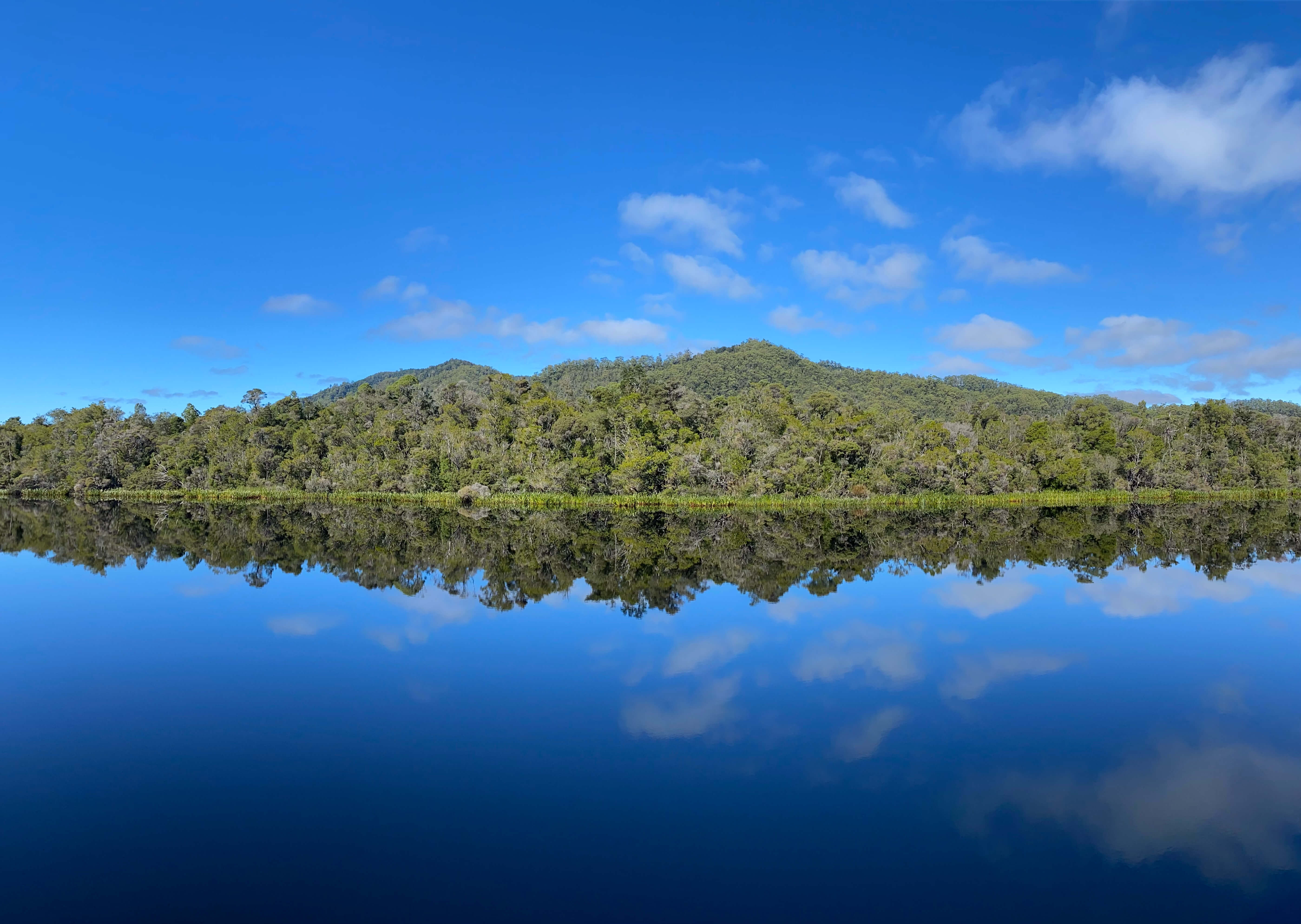
This is an incredible place, and feels empty of human concern. Looking south across the Gordon River, there is likely not a single human being between you and Antarctica. The protected areas and world heritage site are so isolated that only a single road links the West Coast to the East.
The plaque located near where the photo above was taken said there was evidence of human habitation from over 40,000 years ago. The Parks Tasmania website says 35,000 plus – either way, it’s a staggeringly long time, and mostly incomprehensible.
The Australian landscape does not look like anywhere else on Earth. The Tasmanian landscape does not look like anywhere else in Australia. It has muddy hues of red, lime, orange, white and green that appear across great grassy plains, dramatic rocky highlands, glacial lakes, quiet white beaches and tannin creeks.
These photos were taken on my iPhone 11 Pro across the Tasmanian southwest.
Beautiful green hills on the highway out towards hydro country. In the spring and autumn, the paddocks and fields are bright green. In the summer, their hues shift to orange and red – the typical dry country you might otherwise associate with Australian agriculture.
The Tasmanian Highlands are found at the end of a long and winding road gaining elevation in “hydro country.” The Hydro-Electric Commission (H.E.C.) was a huge presence in Tasmania for a long time. The government-owned company exists as Hydro Tasmania today, with a much worse name and logo. Hydro’s dramatic hydroelectric schemes in the 20th Century formed some of the lakes found in Tasmania’s interior.
The rivers and lakes out here are filled with tannin, which colours the water red and amber where it meets the shore. The shores of the lake are lined by fallen, bleached trees that were flooded after the dams downstream were built.
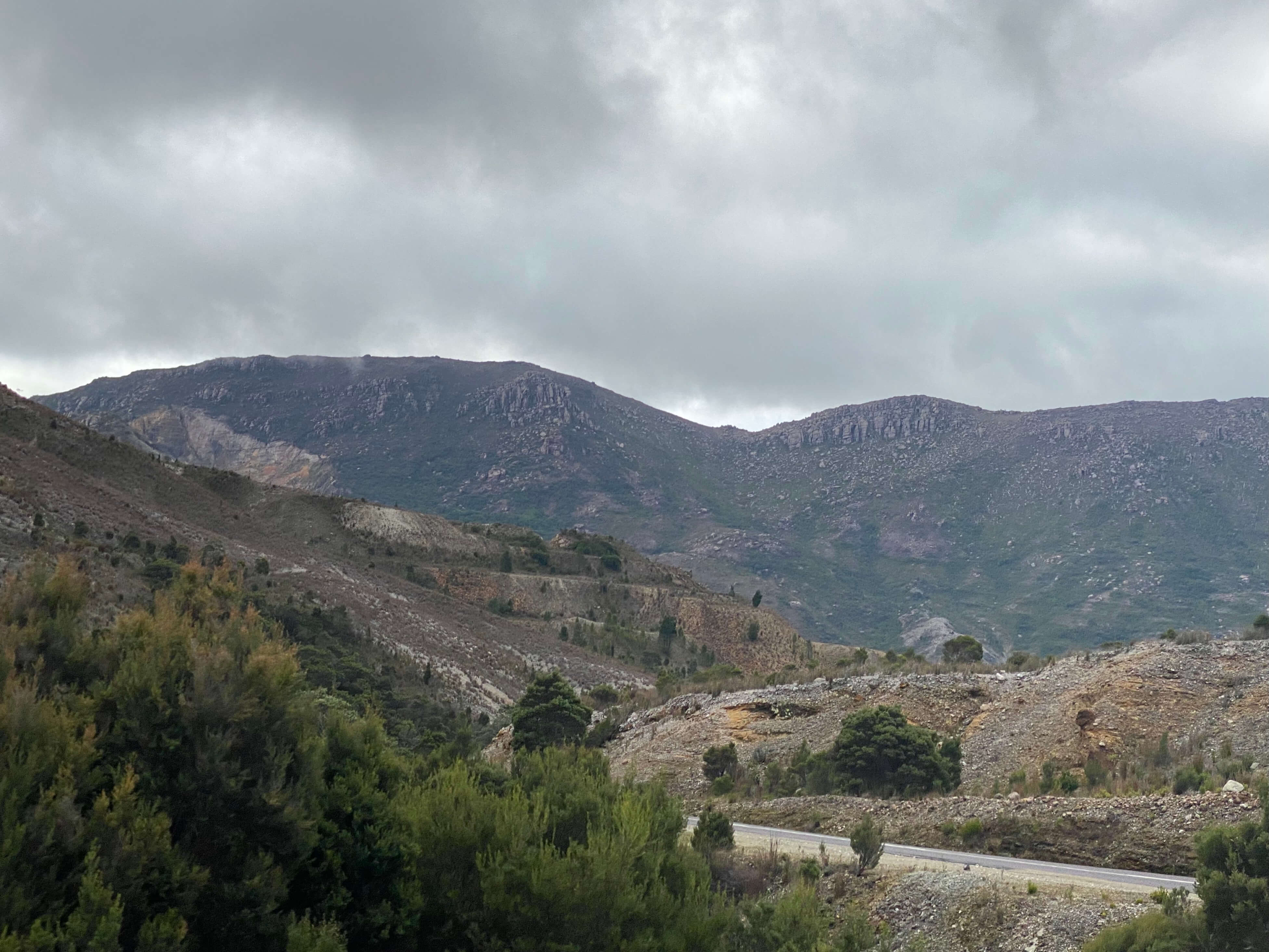
The highlands precede some very un-Tasmanian mountain scenery, which remind me of the American Pacific Northwest. You can see the exposed, rocky peaks of the mountain ranges, which are indicative of the area’s glacial history. The grassy plains in the first picture are populated by a type of native grass commonly called ‘button grass.’
The ruins of the Royal Hotel sit along the highway just outside of Queenstown. Built in 1901, the pub burned down in 1910 before being rebuilt. It closed in the early 1950s as the mining towns in the area emptied out. The town of Linda, where the Royal Hotel is located, is a ghost town. One of many in the area.
The barren moonscape of the hills surrounding the mining town of Queenstown. They still mine gold there today. Queenstown is a weird town, and among the last of the old mining towns scattered through Tasmania’s interior.
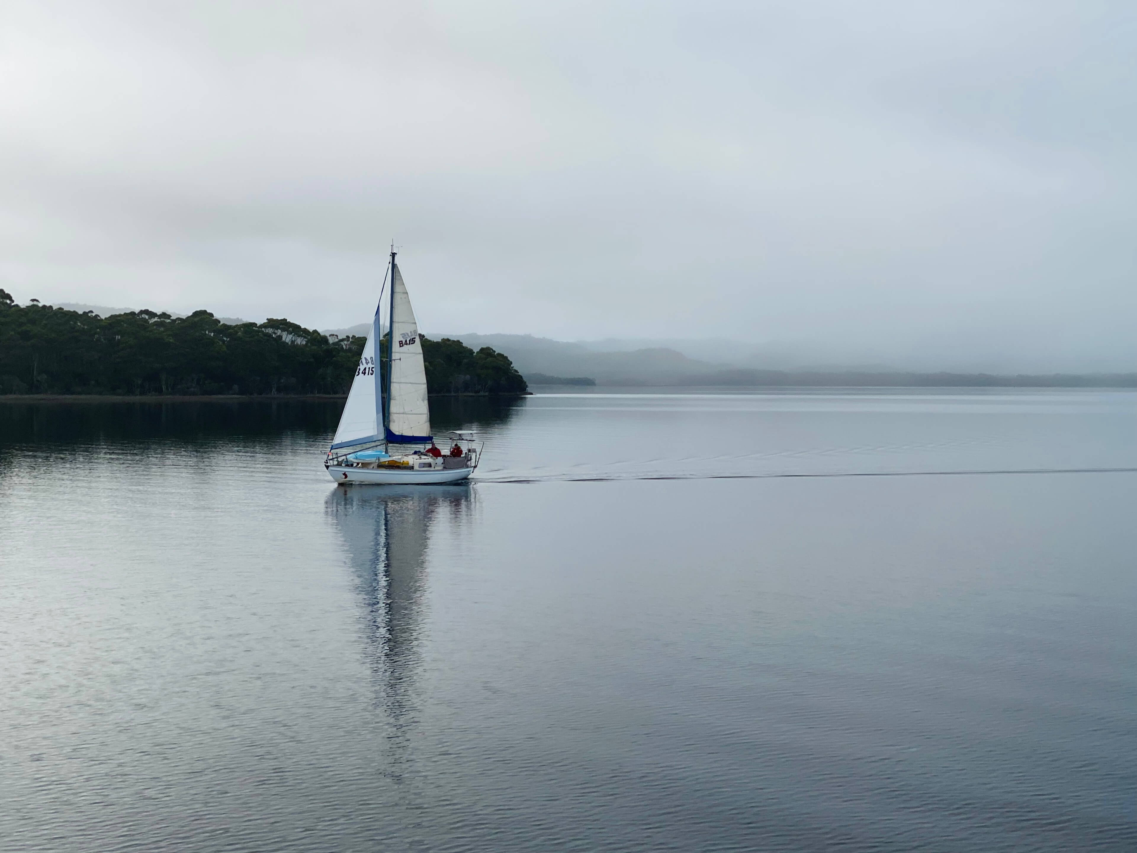
A yacht returns to the jetties in Strahan, which sits on Macquarie Harbour. The overcast weather is typical of the West Coast – when it’s not outright raining.
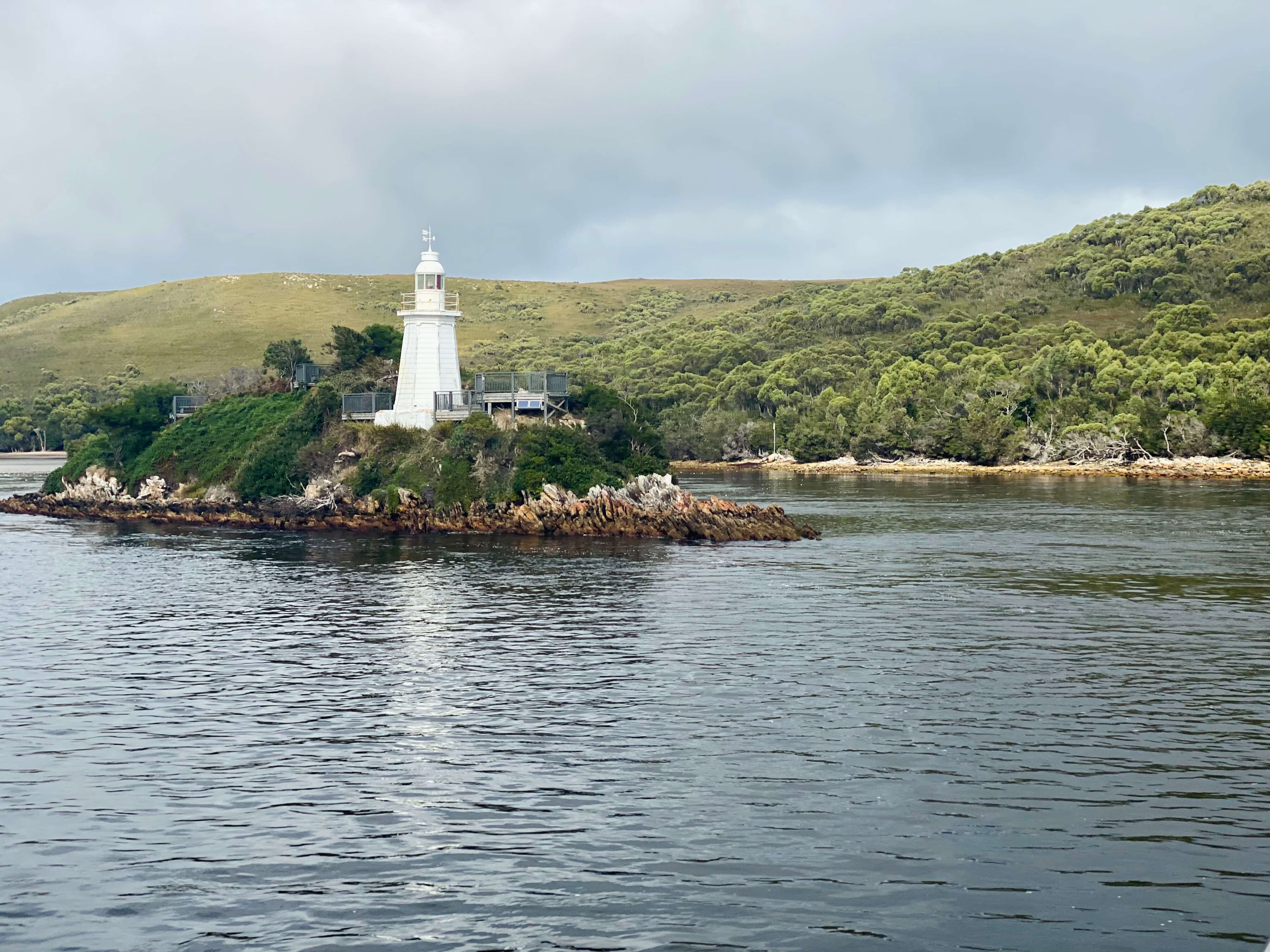
A lighthouse guards the entrance to Macquarie Harbour, called Hell’s Gates. It’s a treacherous pass that has sunk many ships. A few kilometres further into the harbour is Sarah Island, a former penal colony widely regarded as the harshest in the colonial penal system. Today it’s a ruin. It sits at the foot of the Gordon River, where piners would fell Huon pine and send it downstream.
Today, Huon pine is illegal to log. The Parks & Wildlife Service gathers debris that floats into Macquarie Harbour and rations it to mills and furniture makers. It has the nicest smell of any wood in the world – yes, it’s true. It is unlike any other kind of wood smell, and highly sought-after. Today it’s mostly made into bowls and stirring spoons, since it’s very rare for pieces to emerge large enough for tables and chairs. Even 25 years ago you could find colonial furniture made of Huon pine for dirt cheap. Not anymore.
I think about the West Coast a lot. Isolation is a powerful force on the mind. Thanks for reading. ■


